Flying Field
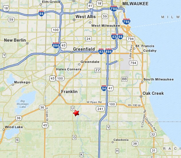
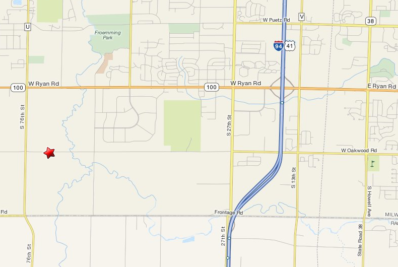
Milwaukee County R/C Model Airplane Field
7000 W. Oakwood Rd.
Franklin, WI 53132
SWARM shares the flying field with
Rainbow Aero Modelers Society (RAMS)
Membership in SWARM does not grant permission to fly at the field.
SWARM works closely with the Rainbow Aero Modelers Society (RAMS).
The field is operated by the RAMS Club on behalf of the public interest
under permit from the Milwaukee County Parks Department.
A separate field license from the RAMS Club is required to fly at the field.
Field License Application
Directions
From the North
Take I-43 South toward MILWAUKEE.
Take I-94 East toward CHICAGO/AIRPORT. (6 miles)
Take the WI-100/RYAN RD exit #322. (0.2 miles)
Turn RIGHT (West) onto RYAN RD. (5 miles)
Turn LEFT (South) onto 76TH ST. (0.9 miles)
Turn LEFT (East) onto W OAKWOOD RD. (0.2 miles)
The flying field is the first driveway on the left.
From the West
Take I-94 East into MILWAUKEE.
Merge onto US-45 South (I-894 East) toward CHICAGO. (5.1 miles)
Merge onto US-43 South towards BELOIT. (1 miles)
Merge onto WI-100 South via exit #60 on the LEFT. (6.9 miles)
WI-100 bends gradually from South to East.
Turn RIGHT (South) onto S 76TH ST. (0.9 miles)
Turn LEFT (East) onto W OAKWOOD RD. (0.2 miles)
The flying field is the first driveway on the left.
From the South
Take I-94 W toward MILWAUKEE.
Take the WI-100/RYAN RD exit #322. (0.2 miles)
Turn LEFT (West) onto RYAN RD (5 miles)
Turn LEFT (South) onto 76TH ST. (0.9 miles)
Turn LEFT (East) onto W OAKWOOD RD. (0.2 miles)
The flying field is the first driveway on the left.

